THIS WEATHER PHENOMENON MAY EXPLAIN UAE AND MIDDLE EAST'S EXTREME FLOODING
A weather phenomenon which can cause catastrophic loss of life and extreme flooding was a major factor behind the severe damage done to the Middle East last year, according to scientists in Abu Dhabi.
The researchers from Khalifa University said that the phenomenon, known as atmospheric river rapids, could have created the floods that brought much of the UAE to a standstill this year.
Atmospheric rivers are long regions that carry water vapour, and within them rapids can form, caused by faster and more turbulent air movement, similar to rapids on land, when water speeds up.
High-intensity atmospheric rivers can be as deadly as hurricanes, according to the United States Geological Survey.
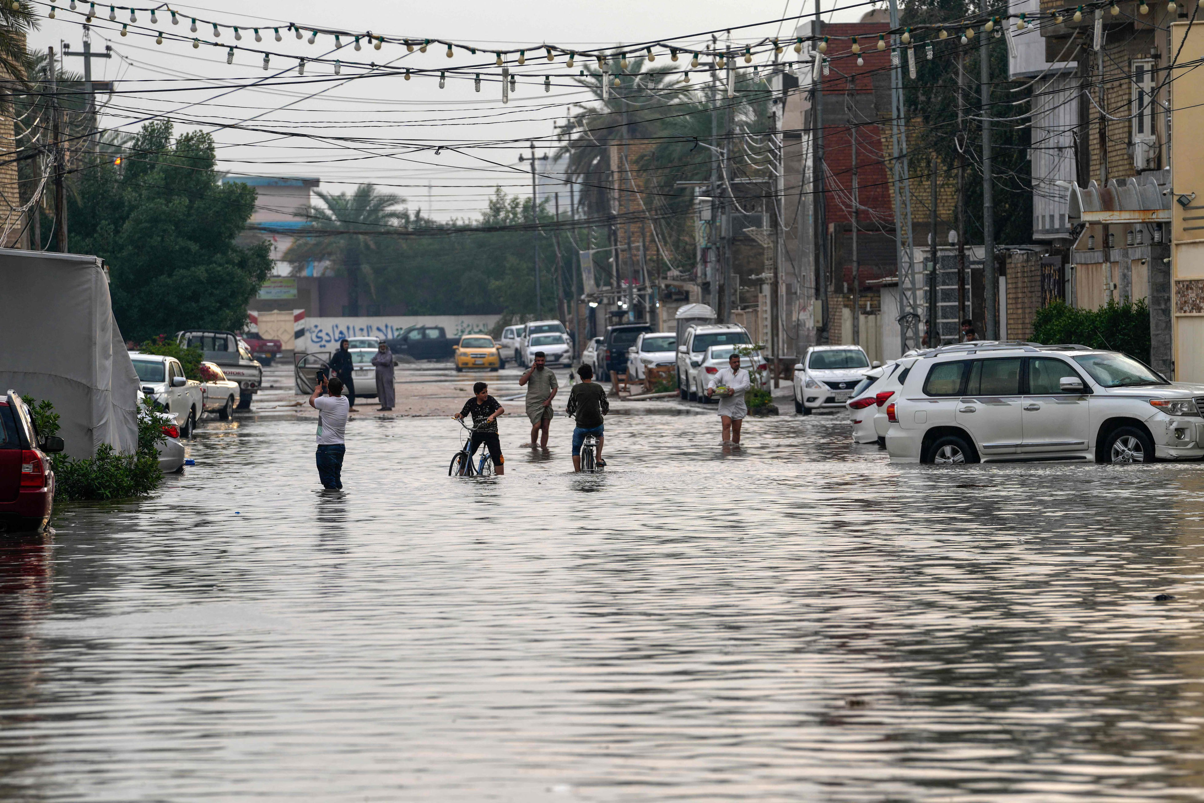
In the study, the Khalifa University scientists analysed the thunder and hail storms of April 2023 that caused death and destruction across Iraq, Kuwait and Jordan.
The study’s first author, Dr Diana Francis, an assistant professor and head of the Environmental and Geophysical Sciences (Engeos) Laboratory at Khalifa University, said atmospheric rivers were “becoming more frequent and intense due to global warming”.
“This is due to the increasing amount of water vapour in the atmosphere as the planet warms,” she said.
“With atmospheric rivers becoming more common and more intense, rapids are following the same tendency.
“We haven’t looked into this year events yet, but it is probable that an atmospheric river and its rapids were present around the cut-off low which pounded the UAE with historical amounts of rain this spring.”
Rapids are caused by steep gradients of temperature, pressure or both within the atmospheric river.
Extreme flooding
In the middle of April, the UAE was hit by the most severe downpours in its history. In some areas, more than 250mm of rain fell in 24 hours.
The storm was caused by a very slow-moving, low-pressure weather system over the eastern Arabian Peninsula embedded in the tropical jet stream, Dr Francis told The National in April.
The latest study, titled Atmospheric River Rapids and Their Role in the Extreme Rainfall Event of April 2023 in the Middle East, was published in Geophysical Research Letters in June.
It was co-written with Engeos researchers Dr Ricardo Fonseca and Dr Narendra Nelli, along with scientists in Chile and the US.
The researchers used satellite data and ground-based observations from weather stations to create a computer model of the atmospheric river that caused the torrential rain of April 2023.
It was found to have drawn in moisture from separate sources to the south-west, the north-west and the south-east and south and was the strongest atmospheric river on record in the region.
“The atmospheric river gradually strengthened during April 11 and 12 followed by a rapid weakening into April 13, when the storm shifted eastward and the atmospheric river moved over the Zagros Mountains in Iran,” the researchers wrote.
“As the moisture supply was cut off and the atmospheric river moved into high terrain and then further polewards, it quickly faded away.”
Benefit of research
The research could have a practical application, as the scientists said that a better understanding of atmospheric river rapids could help forecasters.
“The development of an index or scale for atmospheric river rapids will be vital for operational purposes and help in mitigating their potential devastating impacts,” they wrote.
“As atmospheric rivers are projected to become more frequent and intense in a warming climate, including in the Middle East, understanding their dynamics in the present climate will contribute to a better comprehension of their projected changes in the future.”
The information currently used for weather forecasting usually cannot detect rapids because they are small-scale structures.
For the same reason, projections of how rainfall in the region will change in future do not, Dr Francis said, take them into account.
She said that the other main cause for extreme rainfall events in the region is the drift of cut-off lows from mid-latitudes towards the Middle East, which is happening more often in the winter and the spring because of changes to two jet streams – the polar jet and the subtropical jet.
These changes are linked to increases in temperature in the Arctic, which Dr Francis said was warming four times faster than the rest of the world, so temperature difference between the Arctic and other regions fall and the jets become slower.
2024-07-03T14:38:13Z dg43tfdfdgfd